Most treks in Nepal forgive a loose itinerary. If you're a day behind on the Annapurna Circuit or you decide to spend an extra night in Namche, nobody notices.
Mustang doesn't work that way. Your Restricted Area Permit starts counting the day you cross into the zone at Kagbeni, and it runs out on a fixed date, no grace period. The checkpoint at Kagbeni checks your permit against your face, not just your paperwork. Miss your Jomsom flight window, and you're stuck, because those planes only fly in the early morning before the valley winds pick up.
I've watched groups plan Mustang the way they'd plan any other trek in Nepal — loosely, with room to improvise — and it costs them a day, sometimes two, standing at a checkpoint arguing with an officer who has heard every excuse already. So this isn't a rough sketch. This is the actual structure we run, day by day, the way I've walked it and driven it more times than I can count.
Day 1 — Kathmandu
This day looks unglamorous on paper, and it's the one people underestimate. Your Restricted Area Permit can't be processed before you land — it needs your visa number, which you only get on arrival — so we use this day to get your passport copies, photos, and visa details into the system immediately. We sit down and walk through what the next nine days actually involve: the altitude, the cold nights north of Kagbeni, what the checkpoints will ask for, what to pack versus what to leave in Kathmandu. It's not a briefing you sit through half-listening. Mustang punishes bad preparation more than almost anywhere else I take people.
Day 2 — Fly to Pokhara, drive to Marpha
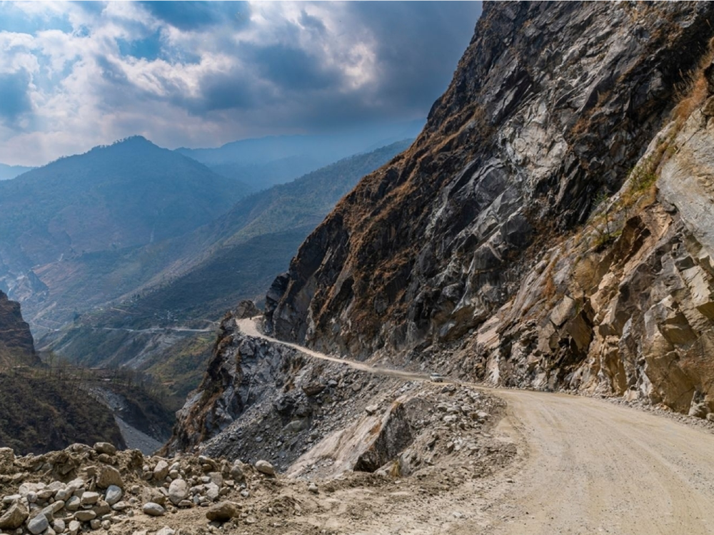
The Kathmandu–Pokhara flight is short, twenty-five minutes, but it's worth the window seat if you can get one — you clear the Kathmandu valley rim, and then the hills open up beneath you. From Pokhara the jeep takes over, and the drive to Marpha runs six to seven hours, following the Kali Gandaki upstream through Beni and Tatopani, where there's a natural hot spring right by the road if the timing allows a stop.
The valley narrows as you go, and by the time you're past Ghasa and Lete you're inside what's officially the deepest gorge on earth — Dhaulagiri on one side, Annapurna on the other, both over 8,000 metres, with barely a few kilometres of horizontal distance between their bases. Marpha itself sits just off the main road, a village of tight stone lanes and flat-roofed houses built specifically to survive the wind that funnels down this valley every afternoon. It's been apple country for decades, ever since a Jesuit horticulturalist introduced the trees here in the 1960s, and the whole village runs on it now — you'll smell the distillery before you see it, where the local wine and a stronger brandy both get pressed and fermented on site. I tell people not to overdo the wine that first night; at nearly 2,700 metres, alcohol sits differently than it does at home, and Marpha is meant to be a soft landing into the trip, not a rough one.
Day 3 — Jomsom, Muktinath, Kagbeni
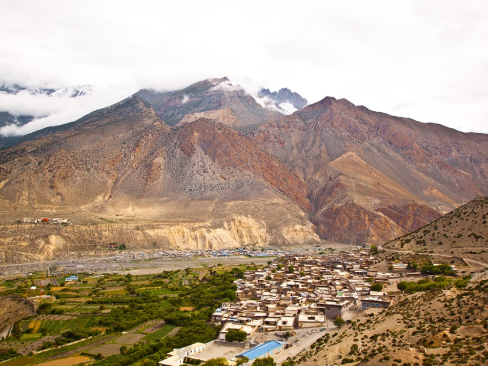
Jomsom is Mustang's administrative headquarters, and it has the feel of it — an airstrip, a market street, government offices, and the kind of Thakali hospitality the whole region is known for. On a clear morning the town sits framed by three ranges at once: Dhaulagiri to the southwest, Nilgiri directly north, and the Annapurnas to the southeast, which almost never happens together this cleanly elsewhere in Nepal.
From Jomsom we drive up to Muktinath, at just over 3,700 metres, one of the holiest sites in the country for both Hindu and Buddhist pilgrims — 108 stone waterspouts ring the temple grounds, and there's a natural gas flame burning beside a spring inside the temple complex that's been alight, by local account, for longer than anyone can date. We've brought clients here who came purely for the trekking and left visibly changed by twenty minutes at that temple, which isn't something we say lightly.
From Muktinath we descend back down into the valley to Kagbeni, and this is the day's real turning point. Kagbeni is a medieval-looking warren of narrow covered alleyways and mud-brick houses stacked on top of each other, still functioning as a normal village, but it's also the physical checkpoint — the last settlement before the restricted zone.
This is where your RAP gets checked against your passport and your face, not just glanced at. Once you're through, Mustang changes register entirely: drier, higher, and visibly closer in architecture and dress to Tibet than to the Nepal you left that morning. We stay the night in Kagbeni, so nobody's rushing that crossing.
If you want the longer version of how this permit system actually works, I've written about it in more detail here.
Day 4 — North through Chhusang, Samar, Syangboche, Ghami
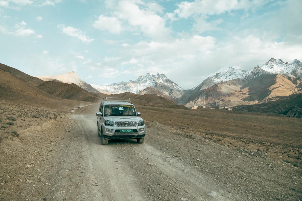
This is the day the terrain stops resembling anywhere else in Nepal. Almost immediately past Kagbeni, the green disappears, and you're driving through wind-carved red and ochre cliffs, canyon walls, and stretches of pure high-altitude desert.
The road threads through Chhusang first, where the trail and river squeeze through a genuinely narrow gap in the rock — jeep drivers who know the route slow right down here, because the gap doesn't leave much margin. From there it's on to Samar, a small village with a scatter of chortens marking the approach, then a climb toward Syangboche, and finally down into Ghami.
Ghami holds one of the longest mani walls in the entire region. It is a stretch of carved stone prayer tablets running for what feels like a genuinely long walk if you get out to look at it properly, and by the time we arrive the cold at this altitude is noticeable even through a good jacket — this is usually where people start reaching for the down layers they packed but hadn't needed yet.
We overnight in a Ghami guesthouse, simple but warm, and the quiet at night up here is a different kind of quiet than lower in the valley.
Day 5 — Ghami to Lo Manthang
The drive from Ghami to Lo Manthang only takes three to three and a half hours, but it's a dense three hours — you climb past the Lo Gyakar Gompa area, cross open plateau, and then, without much warning, the walled city appears ahead of you on the plain, whitewashed and mud-brick against bare hills, looking essentially the way it must have looked centuries ago from this same approach.
There's no gradual reveal the way there is with some destinations — you round a rise, and it's simply there. We check into our guesthouse just inside or near the walls, and let it deliberately leave that first evening unscheduled. People want to walk the narrow streets on their own terms before anyone starts explaining anything to them, and I've learned to let that happen rather than filling the time with a guided orientation walk. Let the place register first, on its own terms, before the history gets layered on top of it the next day.
Day 6 — Lo Manthang, full day
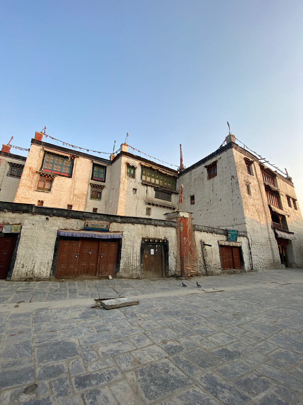
This is the day everything we came for is concentrated into, and I usually build it slowly rather than rushing to see everything before lunch. We start at Jampa Gompa, the oldest monastery in the walled city, built in the early 15th century under the patronage of the Lo kings — the murals inside cover the full height of the walls, faded in places but still holding colour where the light hasn't reached them over the centuries, and the central Jampa (Maitreya, the future Buddha) statue rises through two storeys of the building. You have to let your eyes settle before the detail in the paintings comes forward; walking in from the bright courtyard, the interior reads as almost black for the first minute. From there we move to Namgyal Gompa, sitting slightly outside the main city walls on a small rise, which functions as more of a working monastic school than a museum piece — if you're lucky, young monks are in the middle of their studies when you arrive, and the guide will hang back rather than interrupt.
The afternoon is given to the sky caves of Chhoser, about an hour's drive north of Lo Manthang. These are man-made cave complexes carved directly into vertical cliff faces, some four and five storeys of chambers connected by internal passages and ladders, and archaeologists are still working out exactly how old the oldest sections are — current estimates put parts of the network at over 3,000 years, though nobody claims a firm date for the whole system. We also stop at the Shija Jhong cave nearby, smaller but with its own set of chambers worth the short climb. Standing inside, looking out through an opening cut into rock by people with no modern tools, gives you a sense of scale that the walled city itself doesn't quite match — Lo Manthang is six centuries old; this is older by a factor most people can't really process standing in front of it.
If your dates happen to fall in May, this is also the window for the Tiji Festival, three days of masked ritual dance performed by monks in the palace courtyard, and it's worth checking our dates against it before booking if that's something you want to catch — it's not staged for visitors, and it doesn't move to accommodate a tour schedule. We end the day back in Lo Manthang, usually with enough daylight left for people to wander the streets on their own once more before dinner.
Day 7 — Lo Manthang continues
We slow down deliberately on this day — no fixed schedule beyond breakfast and a rough plan to end up at the palace by mid-morning. The king's palace itself is a five-storey mud-brick structure built by Ame Pal, the founder of the Kingdom of Lo, and it's still standing after roughly six centuries, with the current royal family's descendants living connected to it. You don't get a formal tour so much as a conversation, depending on who's around and what mood the day is in.
After the palace, we let the morning open up. This is when the yak and mule caravans tend to move through, loaded with sacks of grain and supplies coming up from Jomsom, bells audible before the animals round the corner. Women stack dried dung against the outer walls in neat rows for winter fuel; kids kick a ball down an alley barely wide enough for two people to pass. We usually end up sitting at a small tea house near the old assembly hall, and this is where almost every traveller had some of the most honest conversations of any trip — not scripted cultural exchange, just people talking because there's nowhere else to be.
The return route runs through Drakmar, where an ancient monastery sits below striking red cliff formations, and inside there are rock paintings old enough that nobody I've talked to in the region can give you a firm date. Local belief holds that a wish made here comes true — I don't put much stock in that kind of thing personally, but I've never met a guide who skips the chance to say it, and I've never seen a client decline the invitation to make one. We continue south from there, retracing the road but seeing it differently now, heading down toward Jomsom.
Day 9 — Jomsom, celebration dinner
The last stretch back to Jomsom always feels quicker than the drive north, maybe because everyone already knows the road. Once we're settled, we do a proper dinner with the whole crew — driver, guide, the local staff who made the ten days work — and this is genuinely my favourite evening of the trip. It's the one point where the trip stops being something happening around you and becomes something you did together with the people who got you there.
Day 10 — Fly out
An early flight from Jomsom to Pokhara, weather permitting — these flights only run in the calm morning hours before the valley wind builds — and then onward to Kathmandu. Ten days, and by this point most people have gone quiet in a good way, still processing what they just saw.
Why We Run It This Way

I've seen the other version of this trip — groups who booked through an agency that didn't specialise in Mustang, discovered on day three that their guide's restricted-area license wasn't sorted, and lost a day and a half sitting in Jomsom while it got fixed. The permit process here is unforgiving. Your RAP is tied to your guide's license and your visa number, and if either one is off, the checkpoint at Kagbeni will send you back, not wave you through.
We've been running Mustang long enough that this part of the trip is boring for us, which is exactly what you want. Ramkrishna handles the permit filing directly, and our guides for this route are licensed specifically for the restricted area and know the families in Kagbeni, Ghami, and Lo Manthang by name, not just by guidebook description. That matters more here than on most treks — the difference between a guide who can translate what a mani wall means and one who just points at it.
We also keep groups small. Mustang isn't a place that rewards a crowded jeep — the villages are small, the monasteries are small, and a group of four moves through Jampa Gompa very differently than a group of twelve. If walking the route rather than driving it appeals to you more, our full Upper Mustang Trek covers the same ground on foot over 17 days, crossing five passes instead of a windscreen.
Frequently Asked Questions
How many days do you need for a proper Mustang itinerary?
Ten days cover Lower and Upper Mustang by jeep at a pace that doesn't feel rushed, including a full exploration day and a half in Lo Manthang. Shorter versions exist, but they usually cut Lo Manthang down to a single overnight, which isn't enough time in the one place the whole trip is built around.
Do I need a permit for Upper Mustang, and how much does it cost?
Yes. The Restricted Area Permit (RAP) is US $50 per person per day from Kagbeni onward, plus the Annapurna Conservation Area Permit (ACAP). Both are arranged through a licensed agency in Nepal — they can't be obtained at the checkpoint or independently online.
Can I visit Upper Mustang solo?
Yes, as of March 2026, solo travellers can enter Upper Mustang with a licensed guide — the old two-person minimum has been removed. A registered guide is still mandatory regardless of group size.
Is this itinerary a trek or a jeep tour?
This 10-day structure is a jeep-based tour, covering the same route the full Upper Mustang trek walks, but by 4WD. It suits travellers who want the culture, the monasteries, and Lo Manthang without the sustained daily walking and multiple 3,800m-plus passes the trekking route involves.
What's the best time to do this Mustang itinerary?
Spring (March–May) and autumn (September–November) are the standard windows. Less known: Mustang sits in a rain shadow behind the Annapurna and Dhaulagiri ranges, so it stays largely dry through the monsoon months too, when the rest of Nepal is under cloud. Here's more about Mustang in June and July.
Where This Goes From Here
This is the structure we use as a starting point. Every trip we design is customised from here depending on your group, your pace, and what you want to take home from Mustang — some people want more time in Lo Manthang, some want the walking version instead of the jeep. You can see the full breakdown, inclusions, and dates on our Short Upper Mustang Jeep Tour page, or if you'd rather trek the same ground on foot, the Upper Mustang Trek page has the complete 17-day route. Either way, send us an enquiry, and we'll start planning from there.