I've operated this drive enough times now that I can tell you where a client is going to stop talking. It's usually somewhere past Kalopani, when Dhaulagiri shows up on one side of the jeep, and Annapurna on the other, and the road is doing nothing dramatic at all — just following the river, the way it has for the whole trip. That's usually the moment.
Most people planning a Mustang jeep tour ask me about permits, cost, how many days — I've covered what it costs to get here and what to expect once you arrive elsewhere. Almost nobody asks what the road itself actually looks like, which is strange, because for the jeep crowd — the people who want to see Mustang without trekking it — the road isn't a means to an end. It's most of the trip.
This is the Kali Gandaki corridor, the gorge separating Annapurna from Dhaulagiri and, by some measures, one of the deepest gorges on earth — a claim you'll see stated as fact on a lot of travel sites, though the "deepest" title is genuinely disputed among geographers, so I'll put it more carefully: it's deep enough that you feel it, not just read it. You don't get that from the air. You have to drive through it, watching the walls close in and then open again, watching the vegetation disappear kilometre by kilometre until you're somewhere that stopped looking like the rest of Nepal an hour ago.
Here's what that drive actually looks like, section by section.
Pokhara to Beni
The road leaves Pokhara's lake and greenery behind faster than people expect. Within the first half hour, the landscape has already changed register — terraced hillsides, small river crossings, the Seti gorge cutting in and out of view. This stretch is mostly tarmac, and it's the part of the drive where clients are still checking their phones, still half in Pokhara. That doesn't last.
Beni itself is a working junction town, not a destination — a place where the road forks and the character of the trip changes. It's the last town of any real size before the gorge takes over.
Beni to Tatopani
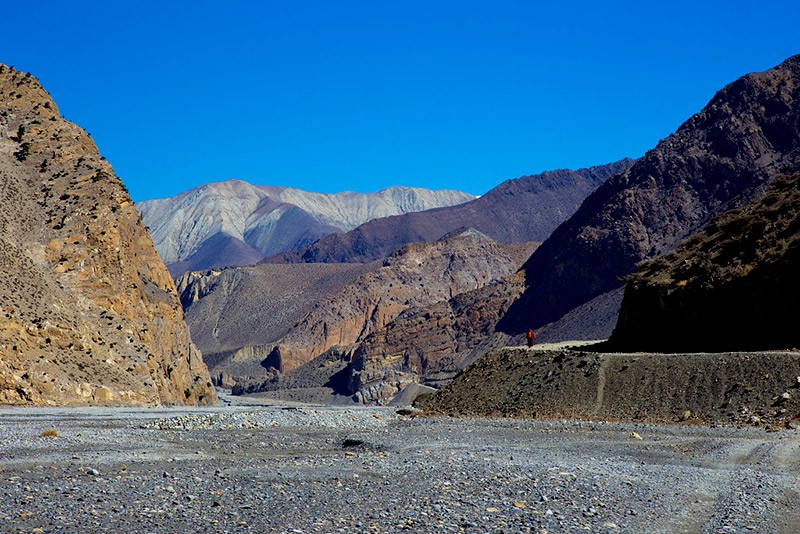
This is where the gorge starts earning its name. The road narrows, and the river below turns that grey-green colour that's pure glacial meltwater — you can watch it churn against rock the whole way. Cliffs rise on both sides, close enough in places that the sky becomes a strip rather than a view.
Tatopani means "hot water" in Nepali, and the hot springs are worth the stop — not as a tourist add-on, but because it's genuinely one of the few places on this route where you can get out of the jeep and sit still for twenty minutes. We build it into the itinerary as a proper break, not a photo stop.
Tatopani to Kalopani
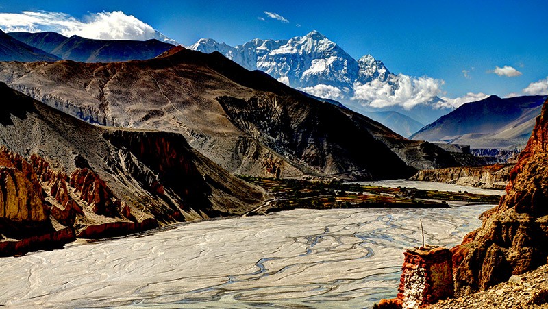
This is the section clients bring up months later. The mountains start appearing properly here — Dhaulagiri holding the western sky, Annapurna answering on the east, both close enough that you stop reaching for your camera because you already know the photo won't hold what you're seeing. The road climbs, the air noticeably thins, and for a stretch there's nothing to say.
A British couple I designed through here in October last year asked my driver, twice, to just stop talking for a while — not rudely; they just wanted the silence. I've learned to read that request coming before it's asked.
This is also where the jeep tour earns its case against every other way of reaching Mustang. A Pokhara–Jomsom flight shows you Dhaulagiri and Annapurna for maybe ninety seconds through a small window. The drive puts you inside that same view for close to an hour.
Kalopani to Marpha
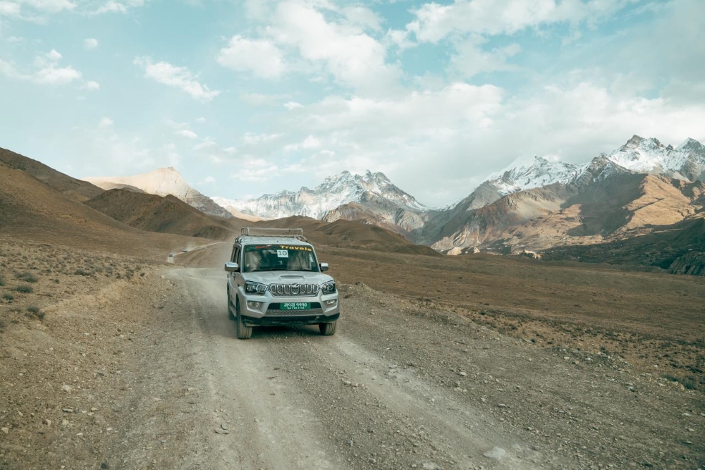
The valley widens out here, and the transformation that's been building since Beni finishes itself. Vegetation thins, wind picks up in the afternoons, and the ground starts taking on that dry, ochre quality that tells you the Tibetan plateau is closer than the map suggests.
Marpha announces itself before you arrive at it — the smell of local apple distilleries carries out onto the road. White-washed, flat-roofed houses stacked along narrow lanes, apple orchards still working the same varieties introduced here decades ago. It's the most photogenic single village on the route, and the one most worth a night rather than a drive-through, if your schedule allows it.
Marpha to Jomsom
A short hop, maybe 30 minutes. Jomsom is the administrative centre of the whole Mustang district — small airport, shops, government offices, the last real town before the landscape gets serious about being remote. Most road itineraries overnight here or in Marpha, less because Jomsom demands it and more because it's a sensible pivot point before Kagbeni.
Jomsom to Kagbeni
Roughly 45 minutes, and the shift in landscape here is sharper than anywhere else on the route. Jomsom is windswept — flat, gusty, functional. North of Kagbeni, the terrain turns austere in a way that's hard to describe until you're in it: fewer trees, sharper light, a stillness that has nothing to do with the wind dying down.
Kagbeni is the checkpoint — this is where your Restricted Area Permit gets checked before you continue north. I've covered what the permit actually costs and how it works elsewhere; this piece is about the road, not the paperwork, so I won't repeat it here.
Kagbeni to Lo Manthang: The Upper Mustang Road
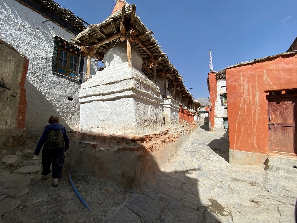
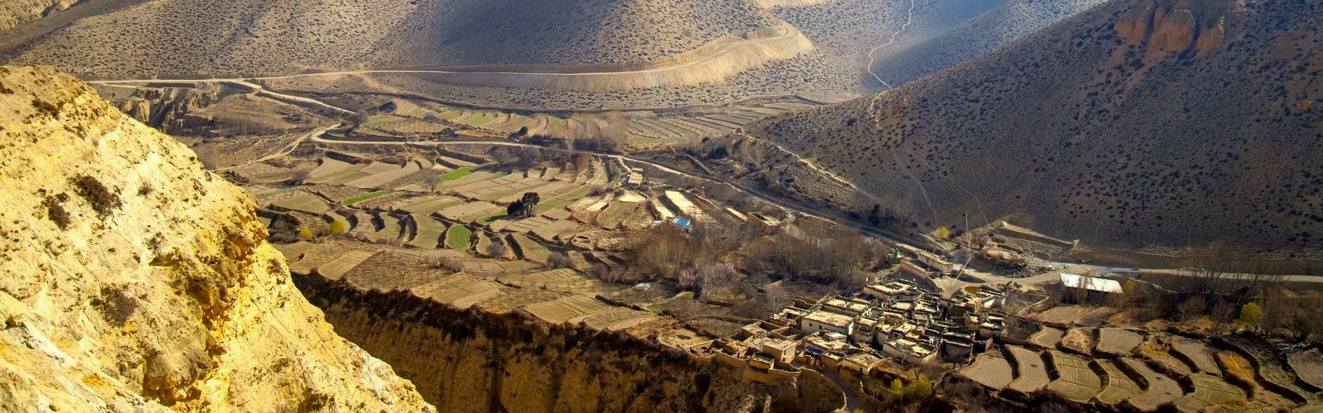
This is the stretch that actually earns the word "expedition." The road is rougher here — dry riverbeds to cross, sections that shift year to year depending on the last monsoon, switchbacks climbing through a series of villages that most travellers to Nepal will never hear named: Chhusang, Samar, Ghiling, Ghami, Charang, each one a small cluster of flat-roofed houses set against red-ochre cliffs, before the road finally levels out onto the plateau where Lo Manthang sits behind its old walls.
There's no single dramatic moment on this last stretch the way there is at Kalopani. It's cumulative — village after village, each one slightly more remote-feeling than the last, until you realise you've been driving through a version of Nepal that has almost nothing in common with where you started that morning.
The Vehicle Matters More Than People Expect
We run this route in 4WD jeeps — Mahindra Scorpios, built for the terrain rather than comfort for its own sake. The road is mostly manageable, but the rough sections between Kagbeni and Lo Manthang aren't something a standard vehicle, or an inexperienced driver, should take on. This isn't a self-drive trip. Driver experience on this specific road — knowing which riverbed crossings to take slowly, which switchbacks tighten unexpectedly — is the difference between a long day and a bad one.
If the road itself isn't the point for you and you'd rather see Lo Manthang without four to six hours a day in a jeep, a private helicopter charter from Pokhara is the other option — weather-dependent and priced accordingly, so it's not something we build a standard itinerary around. If that's what you're after, get in touch, and we'll tell you honestly whether the skies and your dates make it realistic.
Frequently Asked Questions
How far is Pokhara to Mustang by road?
Pokhara to Jomsom is roughly 155 km and takes 6–8 hours by jeep, depending on stops. Continuing north to Lo Manthang adds another day on top of that. For the Kathmandu-side numbers too, see how to reach Mustang from Kathmandu.
Is the Mustang road paved the whole way?
Most of the Pokhara–Jomsom stretch is blacktopped as of 2026. North of Kagbeni into Upper Mustang, expect rougher, unpaved sections, particularly around river crossings — this is the stretch where vehicle and driver experience actually matter.
What's the best route for a Mustang jeep tour — road only, or road and flight mixed?
Most of our clients fly one leg and drive the other. You get the Kali Gandaki gorge flight and still get Marpha and Kagbeni at ground level, which the flight skips entirely. If the drive itself is the reason you're going, do it both ways — that's the point of this whole piece.
Can I drive myself to Mustang?
Foreign travellers can't self-drive into the restricted zone north of Kagbeni, regardless of vehicle, and I wouldn't recommend the lower stretch solo either — this road rewards local driving experience more than it looks like it should from photos.
Which part of the drive is most scenic?
Most clients name Tatopani to Kalopani, where Dhaulagiri and Annapurna are both visible from the road at once. Kagbeni to Lo Manthang is less dramatic in any single moment but more transformative overall — it's cumulative, village by village.
Is there a faster way to see Lo Manthang than the full jeep drive?
A private helicopter charter from Pokhara is the alternative, though it's weather-dependent and priced for it. Contact us directly if you want a straight answer on whether it's realistic for your dates.
How many days should I budget for the full Pokhara–Lo Manthang road trip?
Figure on a minimum of 3 to 4 days each way if you want to actually stop rather than just transit — Tatopani, Marpha, and the Upper Mustang villages north of Kagbeni all reward more than a drive-through. Our Short Upper Mustang Jeep Tour is built around exactly that pace.
Is the Drive Worth It On Its Own?
If you're choosing between flying to Mustang and driving it, this is the honest answer: fly if your time is the constraint, drive if the road itself is why you're going. Most people land somewhere in between, and that's fine — that's why we route most clients one way by air and one way by jeep.
But if you've read this far, you're probably already the person the flight isn't built for. You want the gorge walls closing in, not a ninety-second window of it. You want Marpha at ground level, apple orchards and all, not a flyover.
We run this route often enough to know which riverbed crossings to take slowly and which villages are worth an extra hour. If you want the road, not just the destination, talk to us about a Mustang jeep tour and we'll build the stops around what you actually want to see.
See the Short Upper Mustang Jeep Tour →Prefer Lower Mustang only? See the 5-Day Mustang Tour →