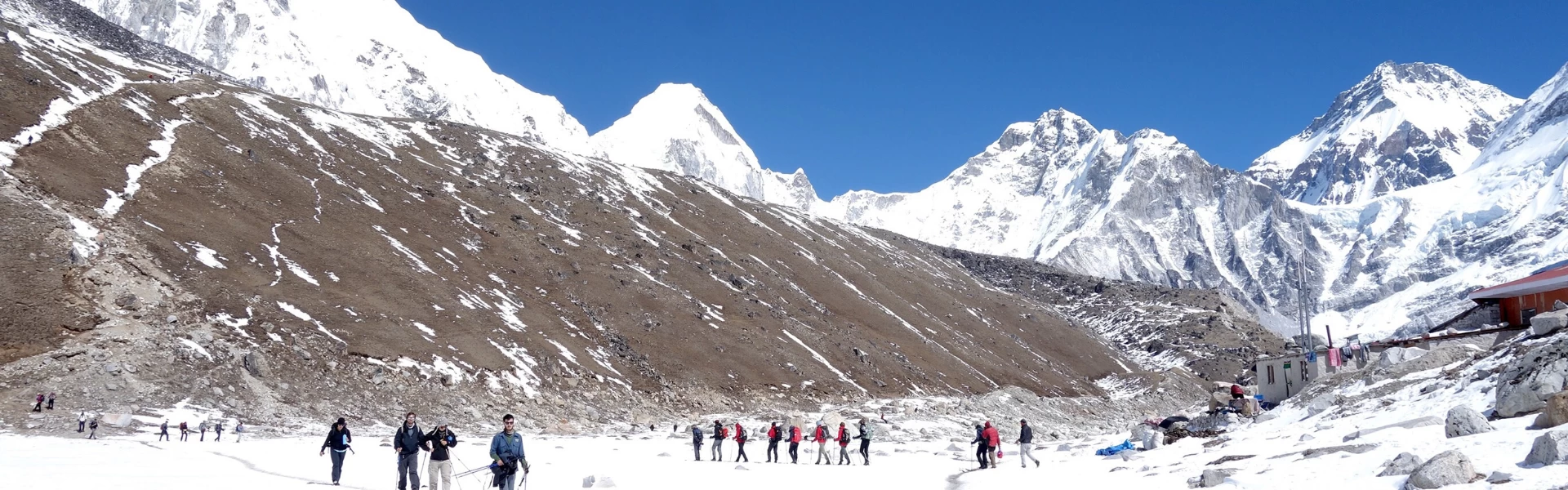
Join the cheapest Everest Base Camp Trek with us.
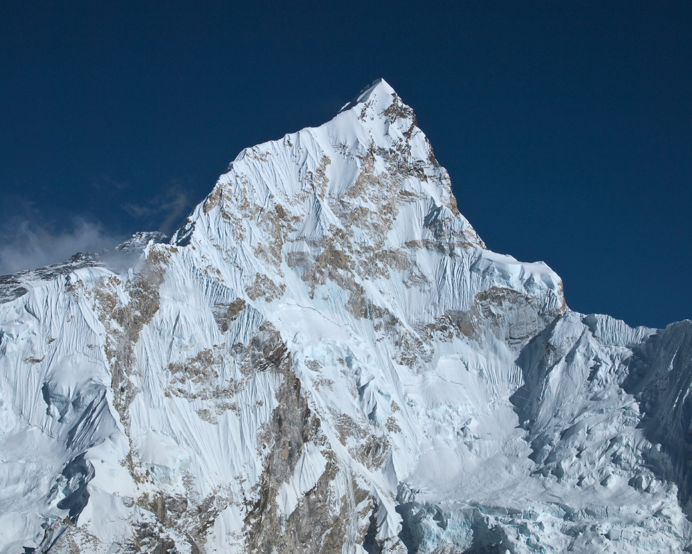
Mount Everest (8,848.86m. | 29,031ft.)
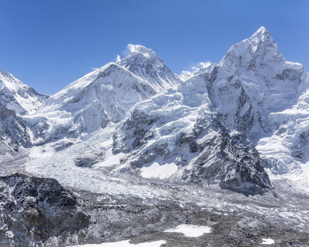 The main goal of the trekkers who attempt the trek is to witness Mount Everest, the tallest mountain in the world. Its summit stands tall at 8,848.86 meters above sea level which is located in the Mahalangur Himal sub-range of the Himalayas. The peak is named Sagarmatha in Nepali, which means head of the sky, and is named Qomolangma (Chomolungma) in the Tibetan language, which translates to Holy Mother.
As a pinnacle of the planet, it attracts a huge number of climbers every year. Up to now, there have been near to 11,000 ascents to Mount Everest summit since the successful summit by Tenzing Norgay and Edmund Hillary in 1953. There are many viewpoints to view the summit of Everest during the trek. Some of the best viewpoints are Everest View Hotel, Kala Patthar, Pikey Peak, and more. Many people believe that you will see Everest from the trail at all times. Moreover, you won’t see the summit from the base camp itself.
Mount Lhotse (8,516m. | 27,939ft.)
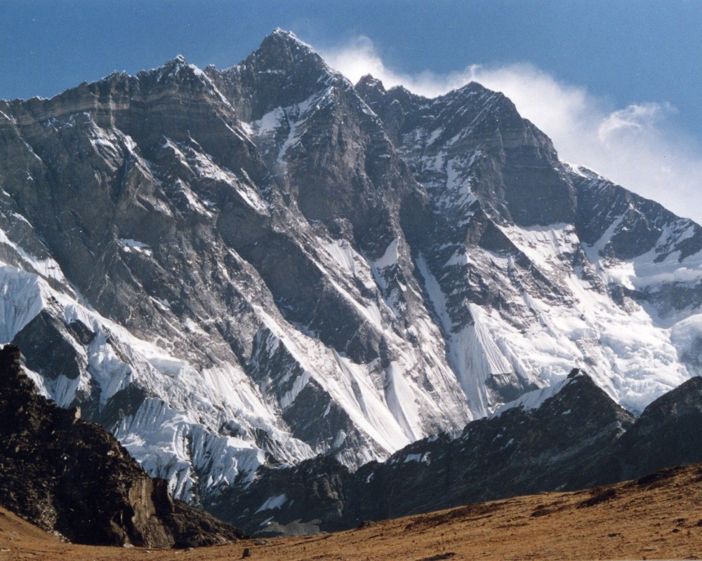
Lhotse, the fourth tallest mountain in the world, lies very close and is connected to Mount Everest via the south col. Lhotse in Tibetan means “South Peak” because of its position in relation to Everest. There are four different summits in Lhotse all of which are above 8,000 meters. The summits are Lhotse Main (8,516 meters), Lhotse Middle (8,414 meters), Lhotse Central II (8,372 meters), and Lhotse Shar (8,383 meters).
The first successful ascent of Lhotse Peak was completed on May 18, 1956, by Swiss climbers, Fritz Luchsinger and Ernst Reiss. Regardless of its close distance to Everest, it is attempted a lot less and hence, it is less crowded. In 2022, experienced climber Nims Dai set a record for traversing from Everest to Lhotse within 26 days. The peak is visible from most viewpoints in the Everest region.
Mount Makalu (8,485m. | 27,837ft.)
Makalu is the fifth-highest mountain in the world located 19 kilometers southeast of Mount Everest. It has a distinct four-sided pyramid shape and is an isolated peak. It also has two subsidiary peaks, Makalu II (7,678 meters) and Chomo Lonzo (7,804 meters).
The peak was successfully climbed for the first time by Lionel Terry and Jean Couzy as a part of a French expedition on May 15, 1955. As a part of the amazing feat, three members of the same group made a successful ascent on May 16 and four of them did on May 17. If you want to enjoy the mountain up close, you can take a trek through the amazing Makalu Valley to reach Makalu Base Camp.
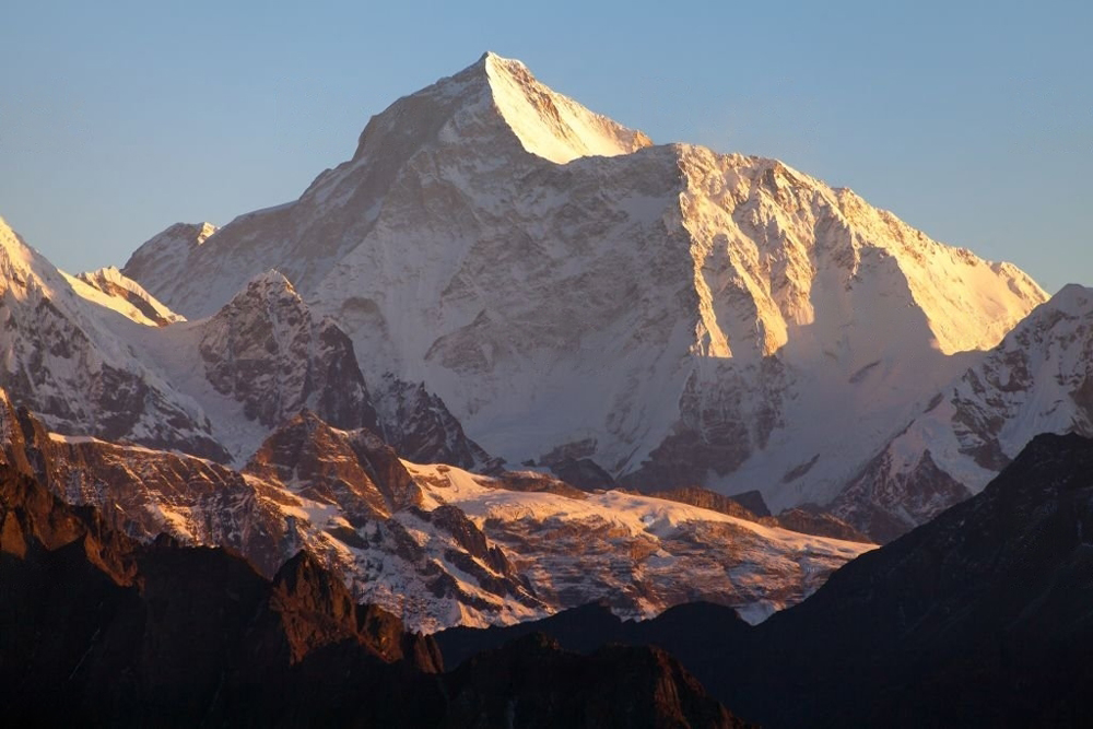
Mount Cho Oyu (8,188m. | 26863ft.)
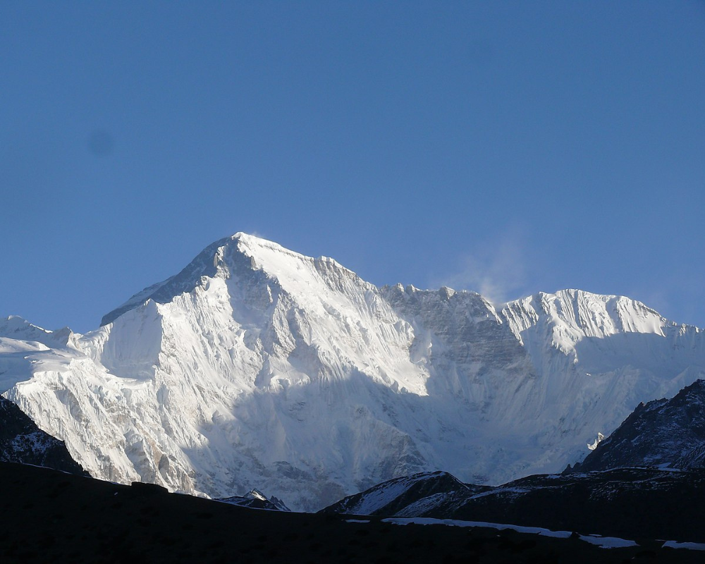
Cho Oyu is the sixth-highest mountain in the world and is considered the easiest to climb among the 8000-ers. Cho Oyu in Tibetan means Turquoise Goddess. It is the westernmost major peak of the Khumbu sub-section of the Mahalangur range. It was considered at one time to be the seventh highest mountain in the world after Dhaulagiri but was later re-measured.
The first successful ascent of Cho Oyu came on October 19, 1954, by the members of an Austrian expedition. The members of the 1953 expedition attempted to summit Cho Oyu as a practice for Everest but retreated from 6650 meters. Due to relatively gentler slopes than other 8000-ers, it is considered an easy ascent. As a result, it is the second most climbed peak over 8000 meters after Everest.
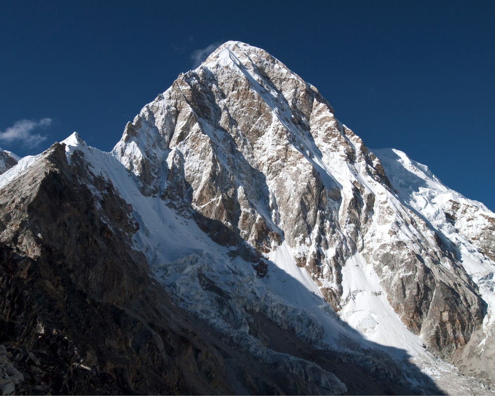
Mount Nuptse (7,855m. | 25,771ft.)
Nuptse is probably the most recognized peak in the region after Everest. The peak lies 2 kilometers west of Mount Everest. Nuptse in Tibetan translates to “West Peak.” Because the majority of the trekker traffic is in the Nepalese southern side, it seems more prominent than Everest itself. However, its topographical prominence is just 319 meters and therefore, is not listed among the highest mountains in the world.
Nuptse was first climbed by Dennis Davis and Sherpa Tashi on May 16, 1961, and also subsequently on the very next day by other members of the same British expedition team. Unlike Everest, Nuptse looks spectacular from the Everest base camp.
Note: Some people opt to fly back to Kathmandu on a helicopter upon completion of the trek. You can enjoy breathtaking views of the mountains in a helicopter. You can also take a helicopter flight to Everest if you are not into trekking.
Mount Pumori (7,165m. | 23,507ft.)
Pumori which means “the Mountain Daughter” in the Tibetan language was named by legendary British mountaineer George Mallory. Mallory also named it Clare Peak after his daughter. People sometimes refer to the peak as Everest’s daughter. It is a beautiful peak that can be seen from Kala Patthar, which is also an outlier of the mountain.
At 7,165 meters (23,507 feet), Pumori is a little easier to ascend than 8000-ers and many people who attempt to scale Everest also try Pumori. Its popularity is growing among alpine climbers. It was first climbed successfully by Gerhard Lenser on May 17, 1962, as a part of the German-Swiss expedition team.
Mount Ama Dablam (6,812m. | 22,349ft.)
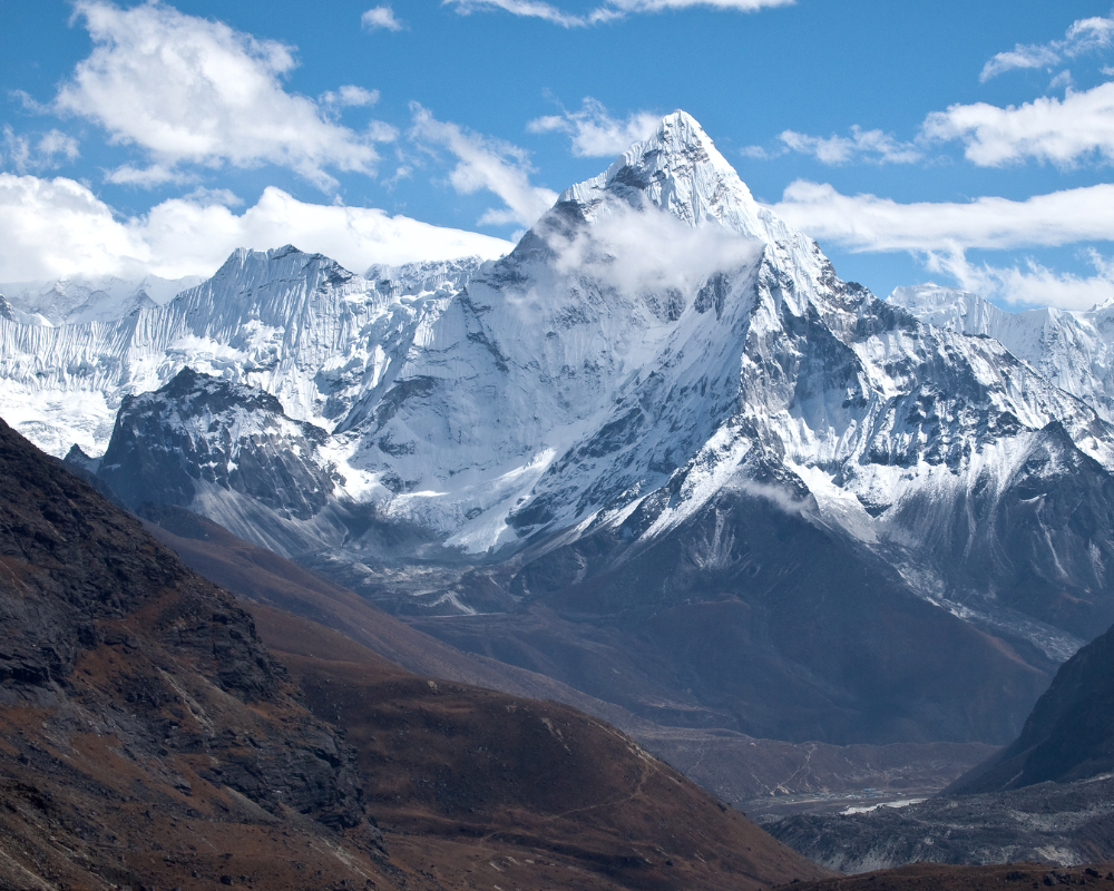
Ama Dablam, often considered the most beautiful in Nepal, is a mountain peak that lies 15 kilometers south of Everest. Ama Dablam translates to “Mother’s Necklace” named because the ridge of the mountains looks like the mother’s arm and the glacier is considered to be Dablam, a traditional pendant worn by Sherpa women.
Ama Dablam is the third most popular peak among alpine climbers. Due to its distinct shape, it is often referred to as the “Matterhorn of the Himalayas.” The first successful ascent of the peak came on March 13, 1961, by Mike Gill and Barry Bishop as a part of Sir Edmund Hillary’s Silver-Hut expedition. The peak is visible and prominent for most of the trail of the Everest base camp trek.
Note: To see all the mountains from the Langtang range to the Mahalangur range, people often take a mountain flight from Kathmandu.
Mount Thamserku (6,623m. | 21,729ft.)
Thamserku is a snow-capped peak that lies east of the Himalayan town of Namche Bazaar and north of the peak Kusum Kangguru in the Mahalangur section of the Himalayas. It is one of the first peaks that you will see during the Everest base camp trek.
Thamserku was first ascended by the members of Schoolhouse members organized by Sir Edmund Hillary. There are agencies in Nepal that specialize in the expedition to the peak of Thamserku.